South Shore Multi-Use Trail, Lewis and Clark Lake
Yankton, SD
Map: www.visityanktonsd.com/wp-content/uploads/2017/05/Maps-Lake-Area.pdf
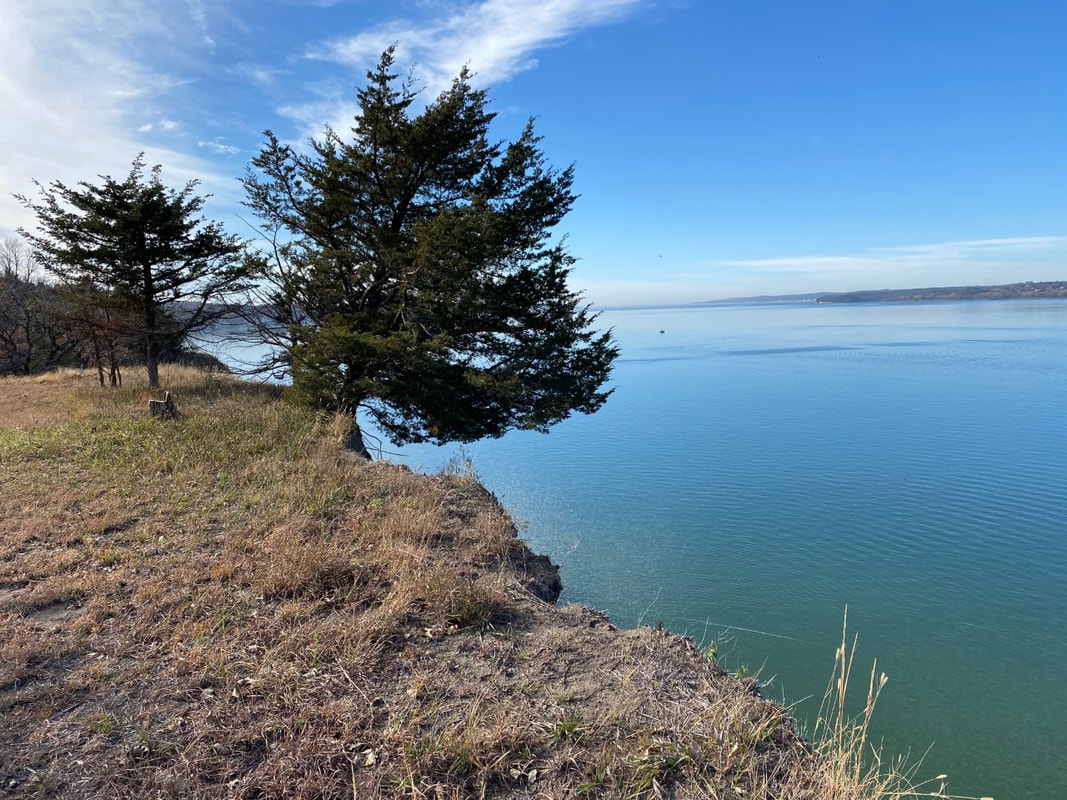
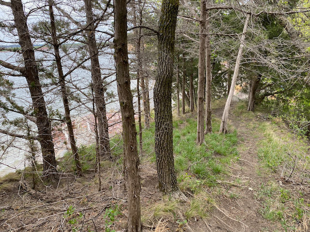
Know Before You Go: This trail runs along the southern shore of beautiful Lewis and Clark Lake near Yankton, South Dakota, through river break country. Parts of the trail can be steep, stretching across the top of the cliffs that are beginning to cave in some spots.
Length: 3.5 to 4 miles, more if you take the spurs
Time: This took us a little more than an hour.
Difficulty level: Moderate, depending on which segment you hike. There is a lot of up and down, and some steep hills.
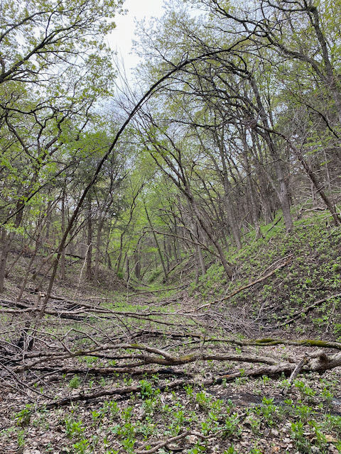
Terrain: Grass, rock and dirt.
Dog-friendly: Yes, but be sure to keep dogs away from the edge of the cliffs.
Kid-friendly: Yes, but be very careful near the edge of the cliffs.
Yankton, SD
Map: www.visityanktonsd.com/wp-content/uploads/2017/05/Maps-Lake-Area.pdf
Know Before You Go: This trail runs along the southern shore of beautiful Lewis and Clark Lake near Yankton, South Dakota, through river break country. Parts of the trail can be steep, stretching across the top of the cliffs that are beginning to cave in some spots.
Length: 3.5 to 4 miles, more if you take the spurs
Time: This took us a little more than an hour.
Difficulty level: Moderate, depending on which segment you hike. There is a lot of up and down, and some steep hills.
Terrain: Grass, rock and dirt.
Dog-friendly: Yes, but be sure to keep dogs away from the edge of the cliffs.
Kid-friendly: Yes, but be very careful near the edge of the cliffs.
|
Lewis and Clark Lake was formed when the U.S. Army Corps of Engineers built Gavin’s Point Dam across the Missouri River. Named for the famous explorers Meriwether Lewis and William Clark responsible for mapping much of the Missouri River, it is framed by gorgeous cliffs along both the South Dakota and Nebraska borders. Many come here to boat, fish, or swim, but this South Shore Multi-Use Trail was a gift we discovered during a quick weekend trip.
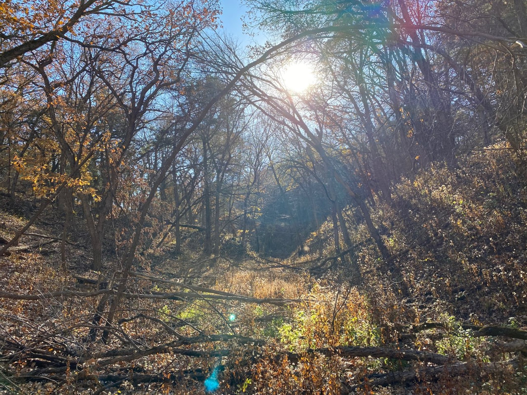
This trail is located near the Weigand and Burbank State Recreation Areas on the Nebraska side of Lewis and Clark Lake, just over the Missouri River from Yankton, South Dakota. Its official address is Crofton, Nebraska. The trail can be used by hikers, horses and bicycles, and is a great trail running trail due to the even, well-maintained terrain. Deciduous trees mix with cedar trees for a fragrant trail that offers spectacular vistas of Lewis and Clark Lake. We found the densely-wooded paths quite peaceful, with trees often forming a cathedral ceiling in many spots. I highly recommend taking any spurs you find. Some of the most beautiful views along the trail occur on these quick side trips off the main path. 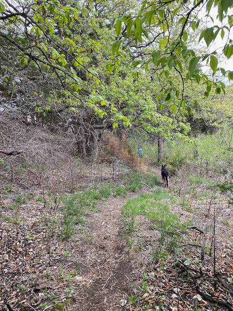
THE HIKING DOGGIE
|
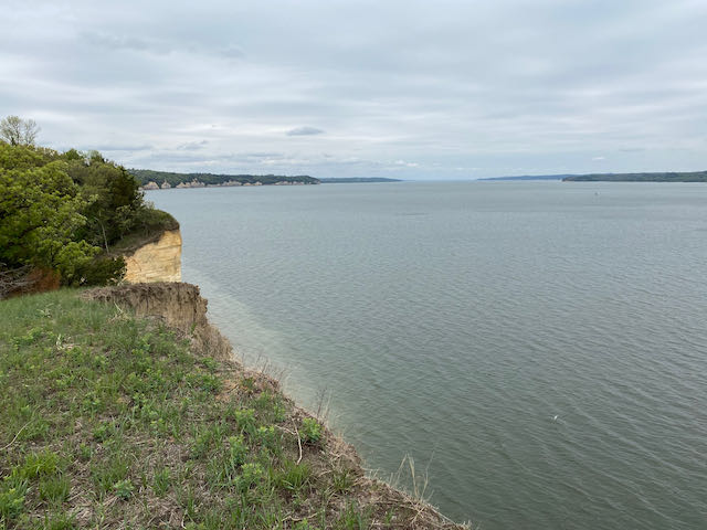
VIEW OF LEWIS AND CLARK LAKE FROM SOUTH SHORE TRAIL
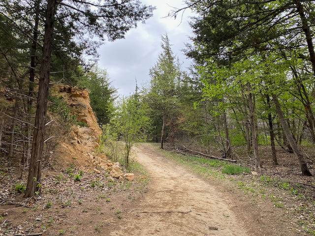
SOUTH SHORE TRAIL

|