Paha Sapa Trail #1 (Decommissioned)
Custer, SD
Map: https://www.trailforks.com/trails/paha-sapa-trail/
Know Before You Go: This trail has been decommissioned and is no longer maintained. It traverses through lowlands that can be guarded by large bands of mosquitoes, especially at dusk. Some areas have thistle that can scratch your legs if you are not wearing long pants. Some of the northbound climbs are challenging. We highly recommend downloading the Avenza app as it shows this trail as an unmarked trail.
Length: 15 miles total out and back, depending on your starting point.
Time: 6.5 hours.
Difficulty level: Difficult – 2,600-foot elevation gain.
Terrain: Rocky, grassy marsh or lowland in some places.
Dog-friendly: Yes, if your dog can handle the miles and the climb.
Kid-friendly: Yes, if your kids can handle the miles and the climb. Our teenager did great.
|
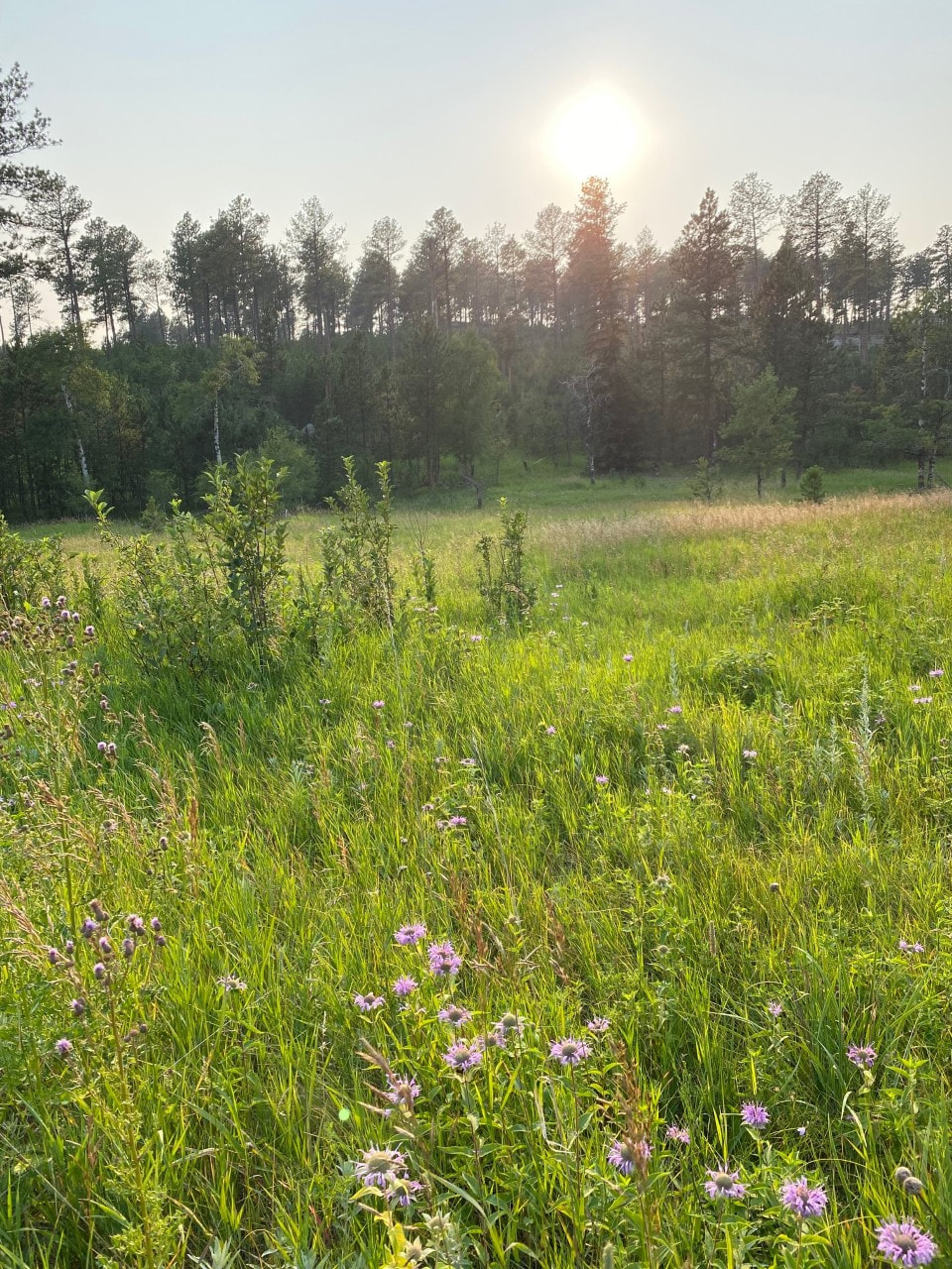
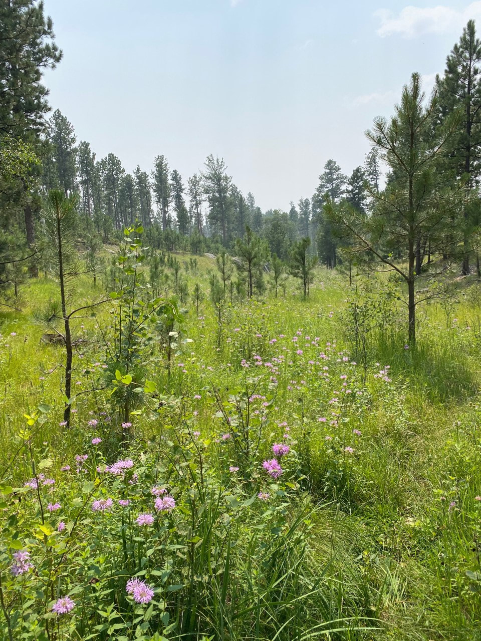
Breathtaking vistas. Amazing meadows. Peaceful solitude. If you are looking for peace and quiet in a beautiful setting, this is the trail for you. We started near America Center Road just off Highway 16A and did not see another soul until we arrived at Sylvan Lake more than 7 miles later.
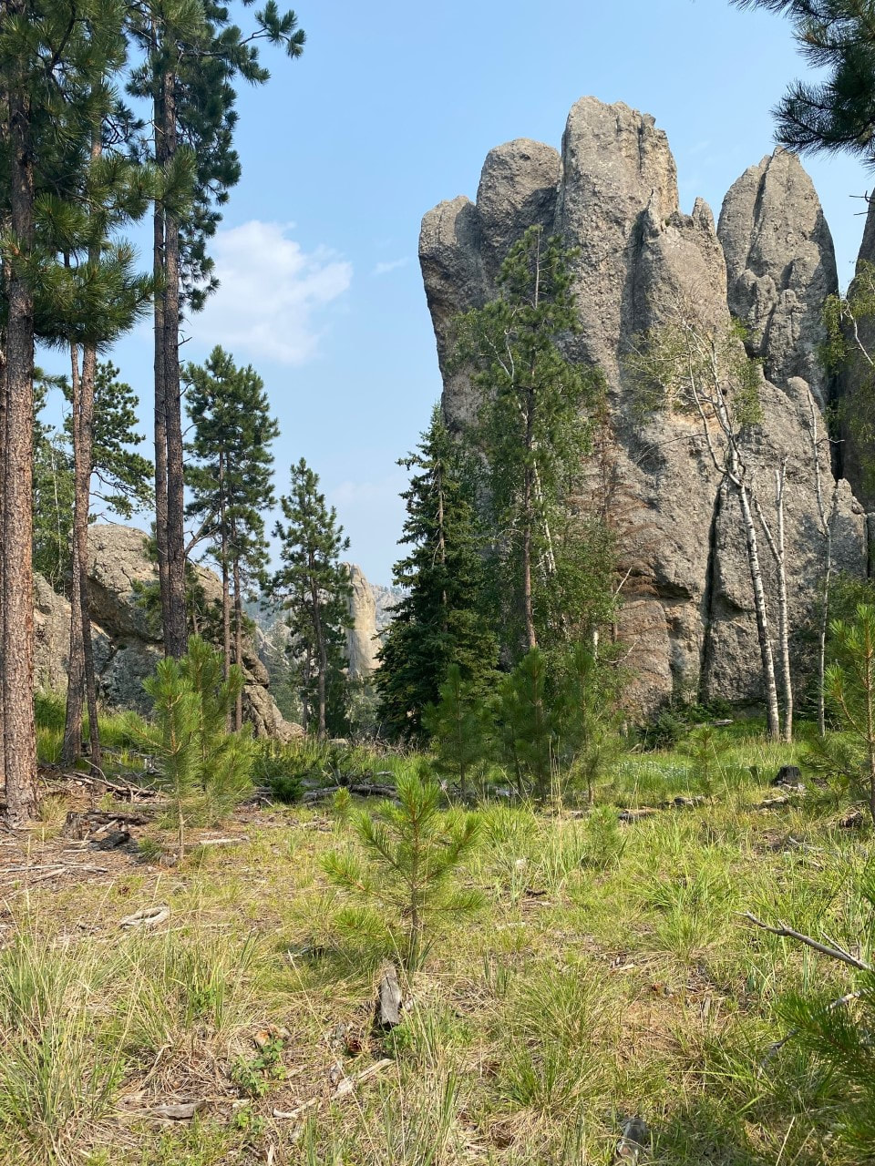
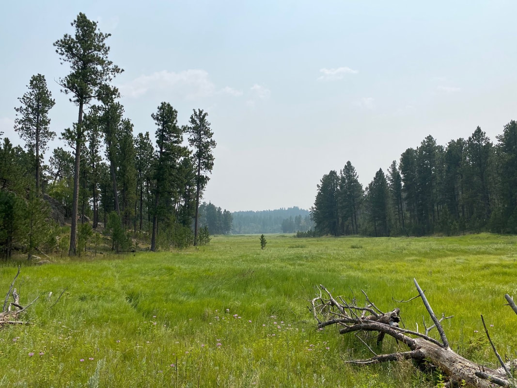
One of the most gorgeous trails in the Southern Hills is what’s referred to as “unauthorized” and “decommissioned”. The U.S. Forest Service decommissioned Paha Sapa Trail #1 years ago, reportedly due to logging effects in the area. Mountain bikers refuse to let it die, however. They have cleared downed trees, marked the trail, and built trail crossings where necessary to sustain one of the Black Hills’ secret treasures. From Trailforks.com: The trail can be accessed by driving three miles east on US-16A from the intersection of US-16/385 in Custer. Turn left on America Center Road and drive for 3.7 miles. You will see several small parking areas on the south side of the road near the last residence. Walk east, and less than a tenth of a mile past the last residence you will see a gate on the north side of the road. We accessed this trail while staying in a rental cabin just off America Center Road. We first met Deb Streets during the COVID-19 pandemic. I worked in communications for a health care system and had worked 6 weeks straight without a day off, often working 10-12 hour days. Deb offered a haven not only from the stress of handling a continuous crisis at work, but also from the pandemic in general. She found out we are avid hikers and suggested we try taking the trail spur she had created on the northeast side of her property up to Paha Sapa Trail #1. Turn left and you can take it all the way to Sylvan Lake, she said. She mentioned that the mountain bikers in the area maintained the trail year round – and she was right. It’s in great shape all the way to Sylvan. We hiked parts of this trail a couple of times before finally committing to the full 15 miles in July of 2021. You need to watch carefully for the lowercase i markings carved into the trees, but they are there to show the way. Keep an eye out for cairns, log ramps and manmade water crossings built by bicyclists. We also recorded our route on our Avenza app, which was helpful on the way up to make sure we were still tracking in the right direction in some places; on the way back, we only had to follow our path. That map is provided here, but keep in mind that we hiked from our rental cabin. There is not a section of this trail that’s not picturesque. Most of it is downright breathtaking. No other trail in the Hills offers spectacular views of the Needles, Harney / Black Elk Peak, and the Cathedral Spires from the south. The vantage point is unlike any other trail or road in the Black Hills. In the low areas, you are rewarded with wildflower meadows with lush grasses. Impossible rock formations catch your eye along the way as well. This is truly a silver lining to the pine beetle epidemic. I wish it hadn’t happened. However, beetles took down trees along this trail in a way that was somewhat fortuitous because it allows hikers to see even more of the amazing views of the entire southern Black Hills. As you near Sylvan Lake, keep an eye and ear out for SD Highway 87 – Needles Highway. The trailhead pops you out around 10 yards east of the trailhead for Little Devils Tower. From there, you can hop on the trail behind the outhouses at the Little Devils Tower Trailhead and trek west approximately half a mile to Sylvan Lake. Snag a Coke, strip off your shoes, and cool your heels in icy lake water before heading back down the hill. This hike is not for the beginning hiker or the faint of heart. 15 miles is a lot over challenging terrain. Our heart rates often hit over 200, and we gained over 2,600 feet. It’s a hike worth training for, however – or worth coordinating with two carloads of hikers so that you can take it one way. This may become our new favorite in the Black Hills. 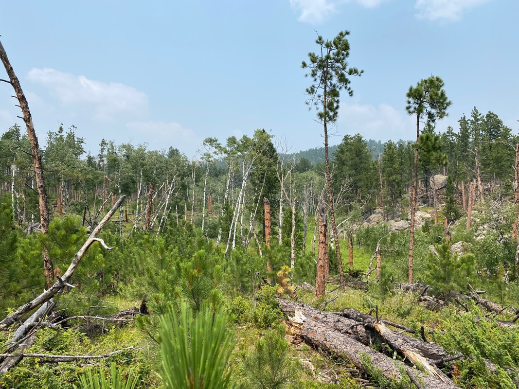
PINE BEETLE BLOWDOWN ALONG PAHA SAPA TRAIL #1
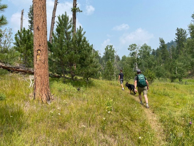
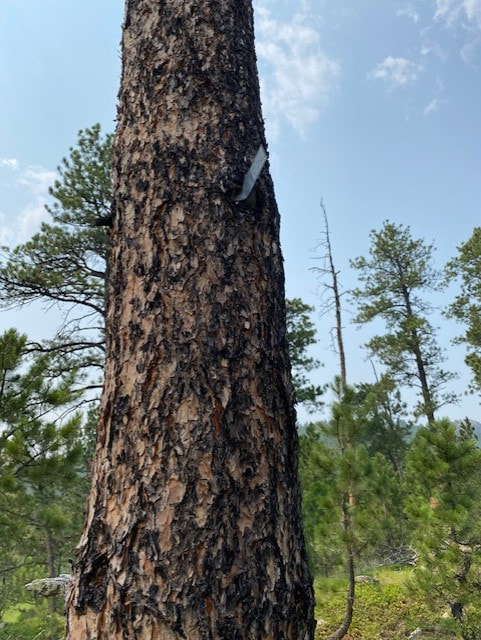
LIMITED TRAIL MARKERS ALONG PAHA SAPA #1
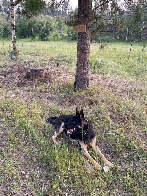
THE HIKING DOGGIE
|
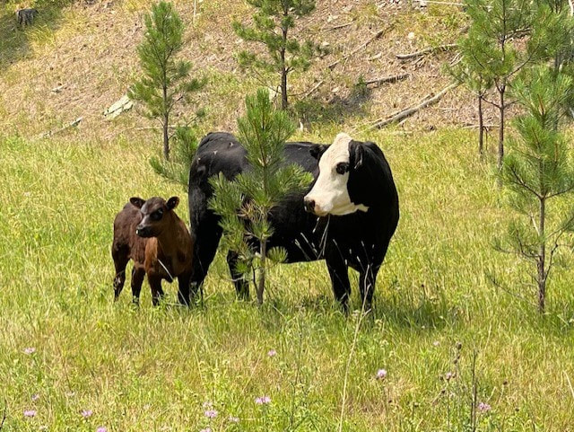
WILDLIFE ALONG PAHA SAPA TRAIL #1
|

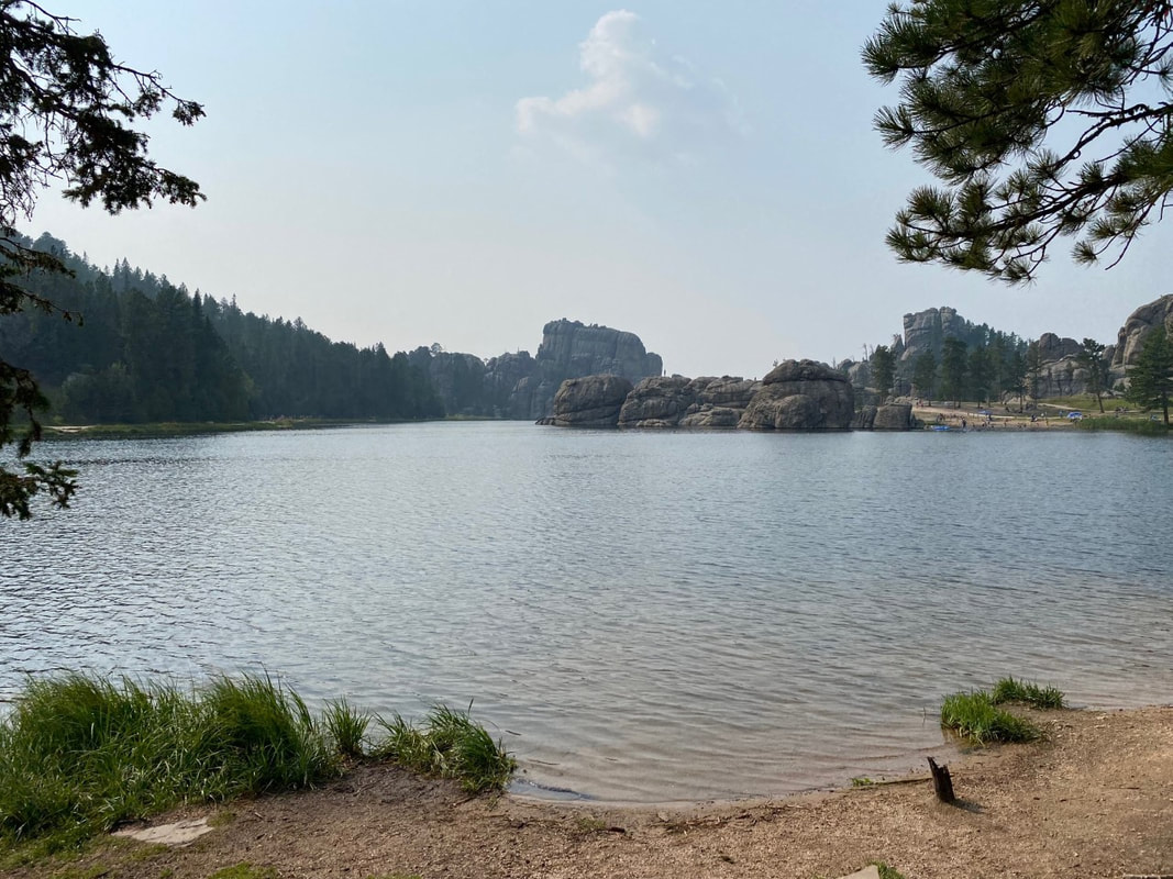
DIP YOUR TOES IN SYLVAN LAKE!