Deerfield Lake Trail #40
Hill City, Silver City, and Rochford, SD
Map: https://www.fs.usda.gov/recarea/blackhills/recarea/?recid=62797
Know Before You Go: This trail runs from Deerfield Lake near Hill City, South Dakota, to Pactola Lake near Silver City, South Dakota. Parts of this trail involve crossing Rapid Creek using logs or railroad ties. Poison ivy can grow in abundance on parts of the trail. In really wet years, this trail has closed in places due to flooding.
Length: 23 miles from Deerfield Lake to the Centennial Trail intersection.
Time: If you bite off the whole thing, we recommend a 2- to 3-day backpacking trip, taking 12-15 hours one way. We usually hike an out-and-back route from one of several trailheads along this trail.
Difficulty level: Moderate, depending on which segment you hike. Parts involve rigorous hills, but much of the trail is relatively flat.
Terrain: Grass, dirt and small rock.
Dog-friendly: Yes, but only bite off what your dog can chew.
Kid-friendly: Yes, but make sure you only plan to hike as far as your smallest legs can go. Consider starting at Silver City for an out-and-back if your kids are not avid hikers.
|
This trail runs from Deerfield Lake near Hill City, South Dakota, to Pactola Lake near Silver City, South Dakota. If you pay attention, this trail is like a tour of the history of the Black Hills. It also gives a great glimpse of several biomes that you find in the Hills.
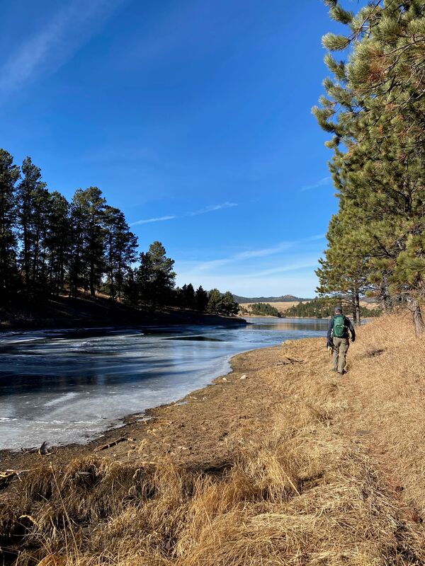
Southwest from Silver City We have done parts of this trail several times with my parents in their mid-70s, our teenage son and our German Shepherd puppy. We often leave from Silver City, a township that sits around 25 miles west of Rapid City along Rapid Creek near the headwaters of Pactola Lake, and head southwest towards Deerfield Lake. Heading southwest of Silver City on this trail rewards you with incredible slate rock formations, majestic old evergreens, gleaming birch, and a beautiful gurgling creek. As you get past the two mile mark, your stream crossings turn from old bridges to railroad ties and logs. When you get closer to Deerfield Lake, the trail leaves Rapid Creek and begins to undulate, making for a little more challenging walk. Silver City holds historic significance because, in 1874, General George Armstrong Custer of the U.S. 7th Cavalry journeyed through this area. During his expedition, gold was discovered. Yes, gold. The area was opened up to miners despite the 1868 treaty, which preserved it for the Sioux Indian Tribe. The township was dubbed “Silver City” by miners who flooded the area from Silver City, New Mexico – and the name stuck. In 1906, the Crouch Line Railroad linked Rapid City to Mystic, running along Rapid Creek. The line was used to move gold and other products out of the region. You trace its route when you walk along Deerfield #40 towards Deerfield Lake. Leaving from Silver City, this part of the trail provides a flat, relatively easy walk along beautiful, bubbling Rapid Creek. Take your fishing pole – I caught the biggest trout of my life near one of the many bridges on this trail. Keep your eyes open for the remains of several historic cabins. One belongs to a Canadian prospector named John Gorman, who mined in the area in the 1870s and for whom Gorman Gulch is named. You may also come across Flanagan’s Cabin, built by a miner named Flanigan in the 1930s. You may also see the remnants of log flumes that carried water from the area. Northeast from Silver City We have rented a small cabin in Silver City and gone the opposite direction the next day. Walking northeast of Silver City, you climb heart-poundingly-steep hills through old pines along Rapid Creek. The trail eventually leaves Rapid Creek and intersects with the Centennial Trail, curving around Veterans Point on Pactola Reservoir – a stunning end to a gorgeous hike. If you have a bit more time, try taking a spur to the right (south) along the first ridge that you cross east of Silver City. Follow the ridge to an old road bed, turning southwest on the old road bed. This takes you to the very old Silver City cemetery, where you can see graves dating back to the post-Civil War era – another historic insight into the history of this area. From Deerfield Lake Alternatively, you can also start from Deerfield Lake and take this trail around the southern side of the lake, heading northeast towards Silver City. This gives gorgeous views of the lake, then takes you down through beautiful meadows along lush waterways. Trail #40 Around Deerfield Lake Trail #40 around Deerfield Lake is fantastic, offering several different biomes and peek-a-boo views of one of the Black Hills’ most beautiful bodies of water. The trail can be a little hard to find in places, but it’s easy to get back on track by looking for trail markers, hitting the forest service roads when you get turned around, and keeping an eye on the lake. Be aware, the trail maps don’t show just how far hiking the trail around Deerfield Lake actually is – we hiked for 17 miles with my 70-something parents and young son one year when we thought we were biting off 10! 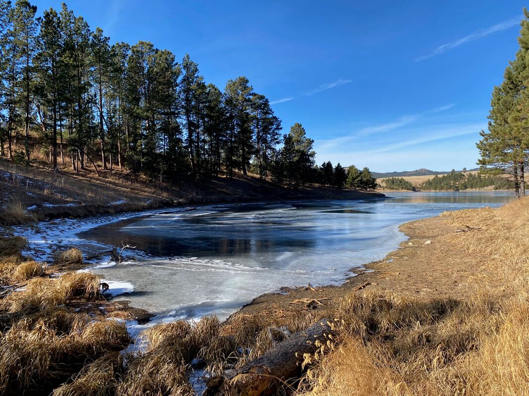
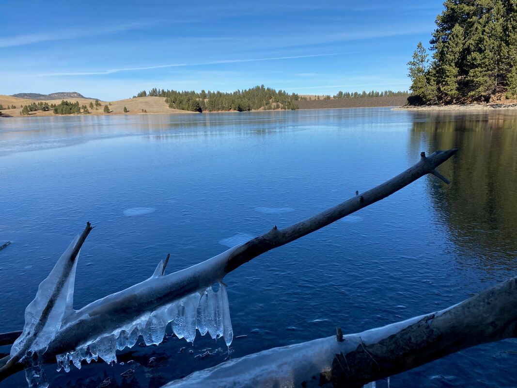
DEERFIELD LAKE #40 LAKE LOOP TRAIL AROUND DEERFIELD LAKE
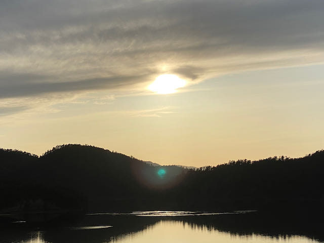
DEERFIELD LAKE NEAR SUNSET
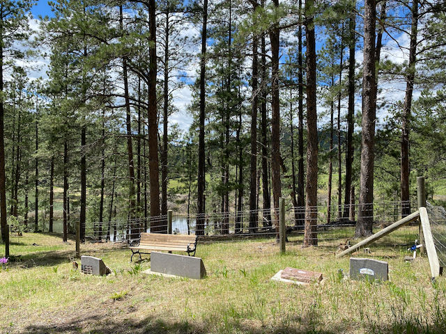
HISTORIC SILVER CITY CEMETARY NEAR DEERFIELD TRAIL #40 HEADING NORTHEAST FROM SILVER CITY
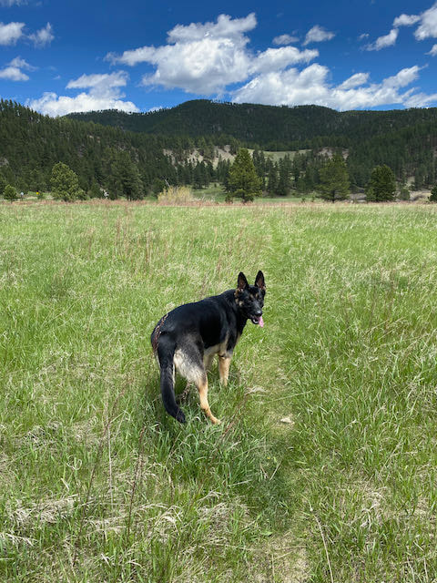
THE HIKING DOGGIE ON DEERFIELD #40 HEADING NORTHEAST FROM SILVER CITY
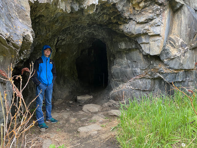
CAVE ALONG DEERFIELD #40 HEADING SOUTH FROM SILVER CITY
|
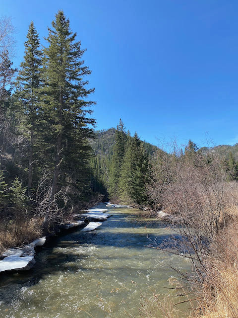
DEERFIELD LAKE TRAIL #40 SOUTHWEST OF SILVER CITY ALONG RAPID CREEK
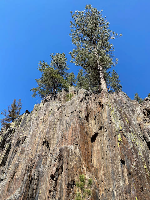
CLIFFS ALONG DEERFIELD #40 SOUTHWEST FROM SILVER CITY
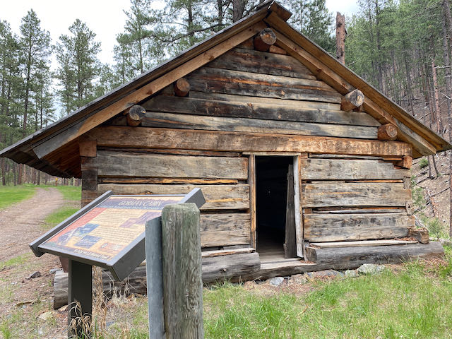
HISTORIC GORMAN CABIN NEAR DEERFIELD #40 TRAILHEAD AT SILVER CITY
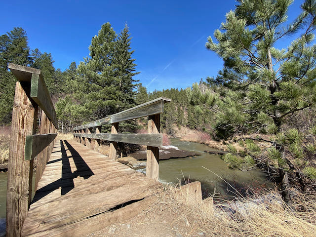
DEERFIELD #40 CROSSES 30 BRIDGES ALONG SLATE AND RAPID CREEKS.
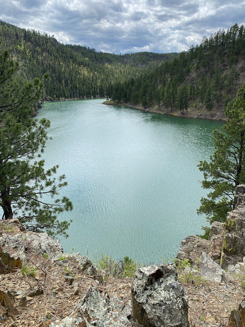
PACTOLA LAKE ALONG DEERFIELD #40 HEADING NORTH FROM SILVER CITY
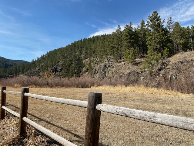
SPLIT RAIL FENCE NEAR SILVER CITY ALONG DEERFIELD #40
DEERFIELD #40 LAKE LOOP TRAIL AROUND DEERFIELD LAKE
|
VIEW OF DEERFIELD LAKE ALONG DEERFIELD LAKE #40 LAKE LOOP TRAIL